Quick answer
Killarney is the standard base for the Ring: the loop leaves from it and there are plenty of rooms. Kenmare is the quieter alternative at the southern end, and the right choice if you split the drive over two days.
On this page
- Ring of Kerry driving itinerary: direction and timing
- The route, stop by stop
- What the driving is actually like
- Doing it in two days instead of one
- What to skip
- Ring of Kerry or Dingle?
- Where to stay for it
- The Gap of Dunloe, which is not part of the loop
- Doing the Ring without driving
- Weather, season and daylight
- Fuel, food and signal
- Two things that are not on the loop
- Where to stop for lunch
- What to bring in the car
- Combining the Ring with the rest of Kerry
- Frequently asked questions
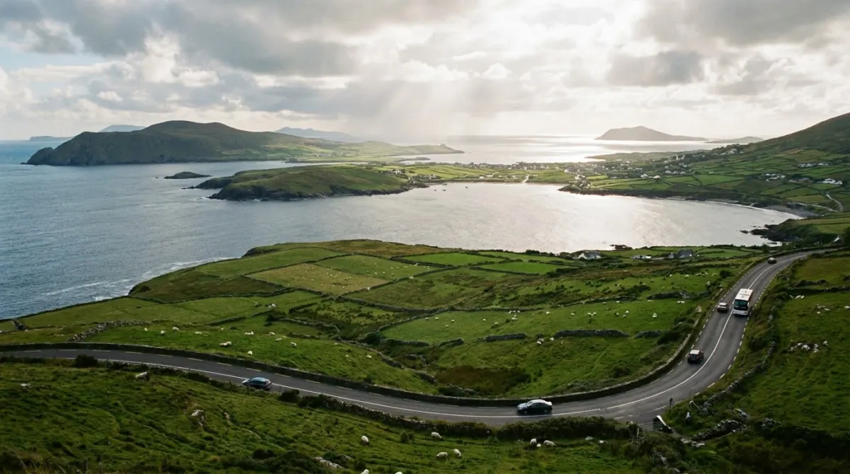
The Ring of Kerry is a 179-kilometre loop around the Iveragh Peninsula, usually driven from Killarney in a day. Most of what goes wrong on it is decided in the first ten minutes: which direction you go, and what time you leave.
Some links below are affiliate links. We may earn a commission if you book through them, at no extra cost to you. We do not rank hotels, and any prices on the map come live from the booking sites.
Ring of Kerry driving itinerary: direction and timing
Tour coaches drive the Ring counter-clockwise — out of Killarney through Killorglin first. On the narrow western sections, driving the opposite way means meeting them head-on at the worst possible points. For a route with time for both the Ring and Dingle, see our 8-day Ireland itinerary.
So: go the same way the coaches go, and leave early enough to stay ahead of them. Out of Killarney by half past eight puts you in front of the first wave for most of the morning.
The loop takes between five and eight hours depending on stops. Treat it as a full day, not an afternoon.
Where to sleep on this route
The route, stop by stop
Killarney to Killorglin (20 km). A warm-up through farmland. Killorglin is a small town on the River Laune, best known for the Puck Fair in August.
Killorglin to Cahersiveen (40 km). The road meets the coast and the landscape turns. Kells Bay and the viewpoints above it are the first places worth stopping.
Cahersiveen and the forts. Two stone ring forts, Cahergall and Leacanabuaile, sit on a side road a few minutes out of town. They are free, they are rarely crowded, and they show how people lived on this coast more than a thousand years ago.
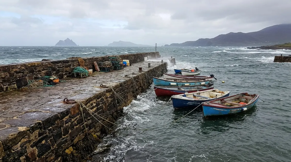
Portmagee and Valentia Island. Portmagee is a harbour village of painted houses, and a bridge from it crosses to Valentia Island. On the island: the slate quarry, the Geokaun viewpoint, and a set of fossilised tetrapod tracks around 385 million years old — some of the oldest evidence of four-legged animals walking on land.
The Skellig Ring. A narrow detour beyond Portmagee that coaches cannot take, which is exactly why it is worth taking. The Kerry Cliffs on it give the closest land view of the Skellig Islands.
Waterville to Sneem (40 km). Waterville sits on a beach between the sea and a lake. The Coomakista Pass above it is the view most people remember from the whole loop. Sneem is a village of coloured houses and a good place to stop for lunch.
Sneem to Kenmare (27 km). Woodland and water. Staigue Fort, a dry-stone fort perhaps two thousand years old, sits up a narrow side road off this stretch.
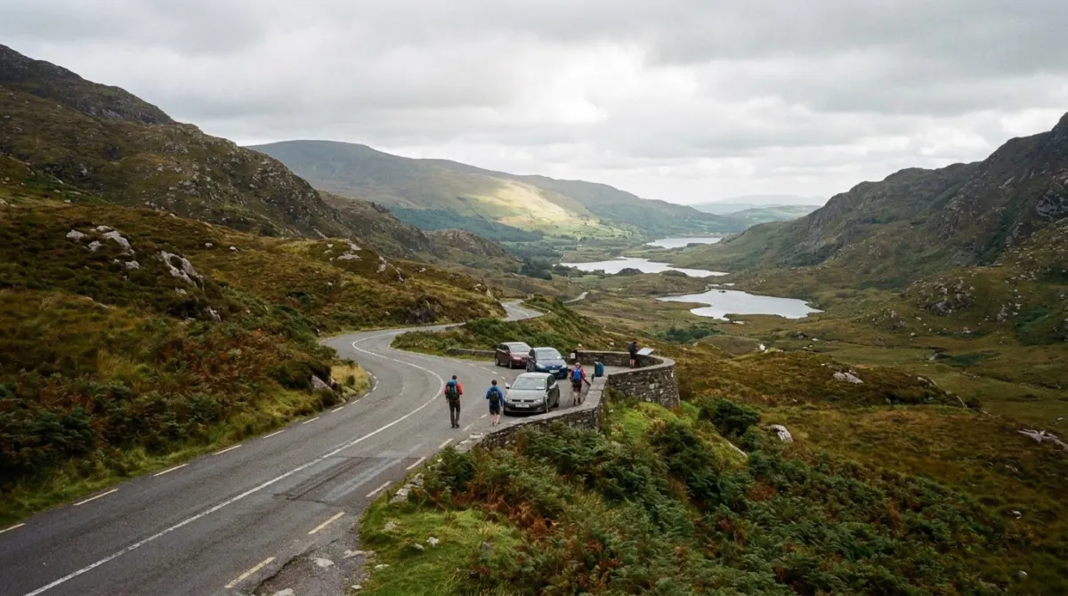
Kenmare to Killarney (32 km). The best driving of the day and the reason to go counter-clockwise: the road climbs through Moll’s Gap and drops past Ladies View, with the three lakes of Killarney below. Finish at Torc Waterfall and Muckross House inside Killarney National Park.
What the driving is actually like
The main loop is a national road and is wider than its reputation. The difficulty is specific and local:
The western section between Cahersiveen and Waterville narrows, with stone walls and no verge.
The Skellig Ring and the side roads to the forts are single-track with passing places. Reversing to one is normal.
Sheep use the road on the open stretches, and they do not move for you.
Allow roughly two-thirds of the speed your navigation app predicts, and do not plan to finish in the dark on your first day of driving on the left.
Doing it in two days instead of one
The loop is more enjoyable split, and Kenmare is where to split it.
Day 1: Killarney to Kenmare the long way round — Killorglin, Cahersiveen, Portmagee, the Skellig Ring, Waterville, Sneem. Night in Kenmare.
Day 2: Kenmare to Killarney over Moll’s Gap, then the national park: Ladies View, Torc Waterfall, Muckross House, and the Gap of Dunloe if there is time.
This also puts the best road of the loop at the start of a fresh day rather than the end of a long one.
What to skip
Said plainly, because the loop has more stops than a day holds.
The Skellig Michael boat landing is not part of this trip. It runs only in summer, depends entirely on the sea, is limited to a small number of permits and books out months ahead. Plan a trip around it or leave it out.
The Gap of Dunloe deserves more than the end of a long day. It is a separate half-day, on foot, by bike or by pony trap.
Killarney town itself can wait until the evening.
Ring of Kerry or Dingle?
If you only have one day, this is the real question.
The Ring of Kerry is longer, more varied and busier. The Dingle Peninsula and its Slea Head Drive are shorter, narrower, more concentrated, and for many drivers better value for the time. Doing both properly takes three days in Kerry.
Map shows live availability and prices. We may earn a commission on bookings made through it, at no extra cost to you.
Where to stay for it
Killarney is the standard base: a tourism town at the gate of the national park, with the loop leaving from it and plenty of rooms. Kenmare is the quieter alternative at the southern end, and the right choice if you split the loop over two days.
Our guide to where to stay in Ireland puts Kerry in the context of the whole trip.
The Gap of Dunloe, which is not part of the loop
The Gap of Dunloe is a narrow glacial pass between the Macgillycuddy’s Reeks and the Purple Mountain, a few kilometres from Killarney, and it is not something to tack onto the end of the Ring.
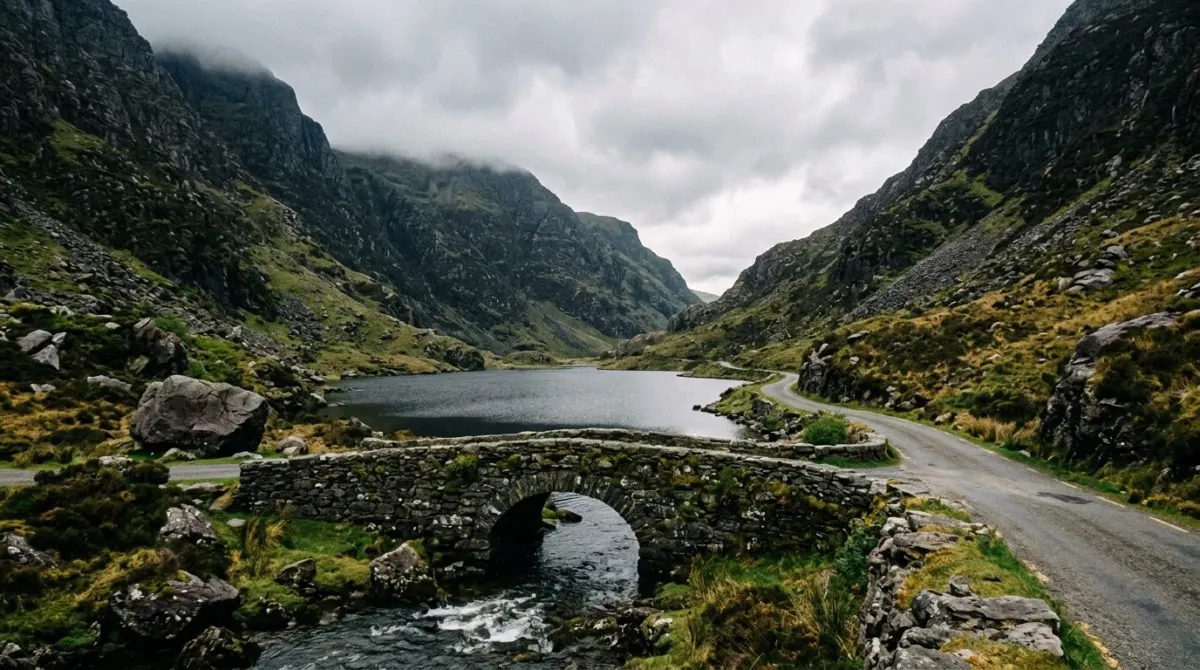
The road through it is single-track, winding and shared with walkers, cyclists and pony traps. Cars are discouraged in the busy season and it is not an enjoyable drive in any case.
The usual way to do it is a half-day: a boat across the Killarney lakes to Lord Brandon’s Cottage and a walk or pony trap back through the gap, or the reverse. Allow four hours and treat it as its own outing.
Doing the Ring without driving
There is no useful public transport around the Iveragh Peninsula, so the car-free version is an organised coach tour from Killarney. These run daily in season, take the counter-clockwise route, and cover the main viewpoints.
What you lose is the Skellig Ring and the side roads to the stone forts, which coaches cannot use. What you gain is not driving a narrow coastal road on the wrong side for you.
Cycling the loop is done, usually over two or three days, and it is a serious undertaking in Atlantic weather.
Weather, season and daylight
The Ring is a view, and the view depends on the day. There is no way to plan around that beyond leaving the loop flexible — if the morning is clear, go.
May, June and September give long days and fewer coaches than midsummer. July and August have the longest daylight and the heaviest traffic. Winter shortens the driving day enough that the full loop with stops no longer fits comfortably, and some places on the route close.
Fuel, food and signal
Three practical points that catch people out on this loop.
Fill up in Killarney or Killorglin. Petrol stations on the western stretch are few and far apart, and some keep short hours.
Plan lunch at Waterville, Sneem or Kenmare. Between villages there is nothing, and in the shoulder season what is there may be closed.
Mobile signal drops in places on the west of the peninsula and through the passes. Download the route offline before you start rather than relying on live navigation.
Two things that are not on the loop
Said plainly, because both get searched alongside the Ring and neither is part of a day’s drive.
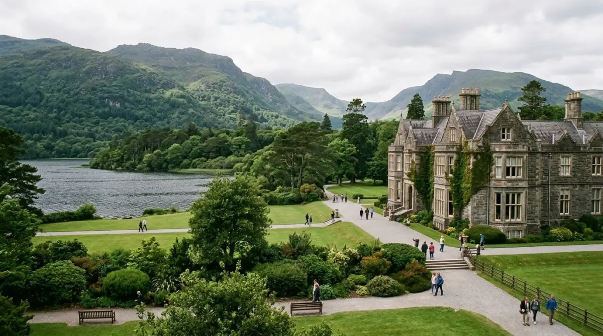
Killarney National Park is its own half day at least: Muckross House and gardens, Torc Waterfall, the lakes and the woodland paths. The Ring runs through its eastern side, past Ladies View, Torc Waterfall and Muckross, but a drive-by is not a visit.
The Beara Peninsula, the next peninsula south, is quieter than the Ring and arguably better, with a cable car to Dursey Island at the end of it. It needs a day of its own and it is reached from Kenmare.
Where to stop for lunch
The loop has three natural lunch stops and long empty stretches between them.
Waterville sits at roughly the halfway point, on a beach between the sea and Lough Currane, and is the usual choice for a counter-clockwise drive.
Sneem, further on, is a village of brightly painted houses arranged around two small squares, and is the better stop if you started late.
Kenmare is the best town on the route for food and the obvious place to end a day or split the loop.
Between these there is very little, and in the shoulder season what there is may be shut. Plan the stop rather than hoping.
What to bring in the car
Nothing exotic, but four things make the day better: a rain jacket within reach rather than in the boot, because the weather changes within the hour; walking shoes, because several of the best stops involve a short climb on wet grass; the route downloaded offline; and cash in small amounts, since a few of the smaller sites and car parks do not take cards.
Combining the Ring with the rest of Kerry
Three days in Kerry covers the region without rushing: one for the Ring of Kerry, one for the Dingle Peninsula, and one for Killarney National Park and the Gap of Dunloe.
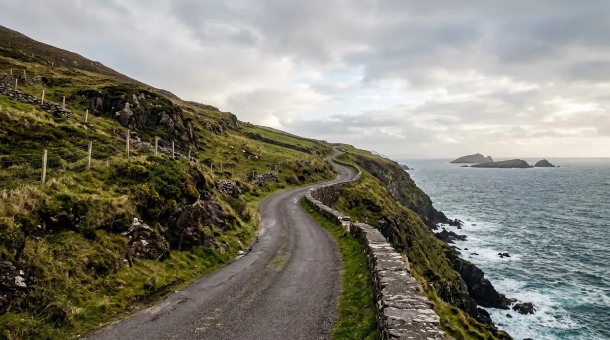
Two days means choosing two of those three. One day means choosing one, and for most drivers Dingle gives more for the time than the full Ring does.
Frequently asked questions
Should I drive the Ring of Kerry clockwise or counter-clockwise?
Counter-clockwise, the same way the tour coaches go. Driving the opposite direction means meeting them head-on on the narrow western sections. Leave Killarney by about half past eight to stay ahead of the first wave.
How long does the Ring of Kerry take?
Five to eight hours depending on how often you stop, for a loop of 179 kilometres. Treat it as a full day. Split over two days with a night in Kenmare, it is a considerably better trip.
Is the Ring of Kerry difficult to drive?
The main loop is a national road and wider than its reputation. The narrow parts are specific: the western stretch between Cahersiveen and Waterville, and the single-track side roads to the forts and the Skellig Ring. Sheep on open sections are normal.
What is the Skellig Ring and should I do it?
A narrow detour beyond Portmagee that tour coaches cannot use, which is why it is worth taking. The Kerry Cliffs on it give the closest land view of the Skellig Islands. Add about an hour.
Can you visit Skellig Michael from the Ring of Kerry?
Not as part of the drive. Landings run only in summer, depend entirely on sea conditions, are limited by permit and book out months ahead. It needs a trip built around it.
Ring of Kerry or Dingle Peninsula?
Dingle is shorter, narrower and more concentrated; the Ring is longer, more varied and busier. With one day, many drivers get more from Dingle. With three days in Kerry, do both and split the Ring over two.
Keep planning Ireland
- Where to Stay in Kilkenny: On the Mile, or Beside the Station
- Where to Stay in Doolin: Book a Room You Can Walk Home To
- Where to Stay in Belfast: Four Quarters, Four Different Trips
- Where to Stay in Killarney: The Town, or the Lakes
- Where to Stay in Dingle: In Town, or Out Where the View Is
- Where to Stay in Ireland: Pick Three Bases, Not Seven
- Where to Stay in Galway: The Noise Decides It, Not the Distance
- Best Hotels in Dublin: What Each Kind of Building Gives You
Written and checked by
Triplarks Editorial
An editorial desk, not an invented persona: research, drafting and fact-checking are done by the same small team. Every number here carries the date it was read.